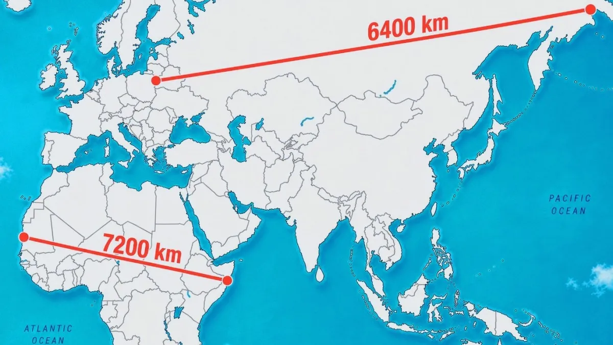
Google Maps uses Mercator projection, which distorts landmass size. It stretches areas farther from the equator, making Russia (6400km) look larger and Africa’s longer 7200km line look short
Google Maps uses Mercator projection, which distorts landmass size. It stretches areas farther from the equator, making Russia (6400km) look larger and Africa’s longer 7200km line look short